


Acton Precinct 1, Middlesex County, Massachusetts
About
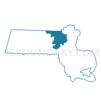
Outline

Summary
| Unique Area Identifier | 594393 |
| Name | Acton Precinct 1 |
| County | Middlesex County |
| State | Massachusetts |
| Area (square miles) | 4.19 |
| Land Area (square miles) | 4.16 |
| Water Area (square miles) | 0.03 |
| % of Land Area | 99.21 |
| % of Water Area | 0.79 |
| Latitude of the Internal Point | 42.51200520 |
| Longtitude of the Internal Point | -71.40794420 |
Maps


Graphs
Select a template below for downloading or customizing gragh for Acton Precinct 1, Middlesex County, Massachusetts


Neighbors
Neighoring Voting District (by Name) Neighboring Voting District on the Map
- Acton Precinct 2, Middlesex County, MA
- Acton Precinct 6, Middlesex County, MA
- Carlisle Precinct 1, Middlesex County, MA
- Concord Precinct 5, Middlesex County, MA
- Littleton Precinct 1, Middlesex County, MA
- Westford Precinct 4, Middlesex County, MA
Top 10 Neighboring County Subdivision (by Population) Neighboring County Subdivision on the Map
- Westford town, Middlesex County, MA (21,951)
- Acton town, Middlesex County, MA (21,924)
- Concord town, Middlesex County, MA (17,668)
- Littleton town, Middlesex County, MA (8,924)
- Carlisle town, Middlesex County, MA (4,852)
Top 10 Neighboring Elementary School District (by Population) Neighboring Elementary School District on the Map
- Acton School District, MA (21,924)
- Concord School District, MA (17,668)
- Carlisle School District, MA (4,852)
Top 10 Neighboring Secondary School District (by Population) Neighboring Secondary School District on the Map
Top 10 Neighboring Unified School District (by Population) Neighboring Unified School District on the Map
Top 10 Neighboring State Legislative District Lower Chamber (by Population) Neighboring State Legislative District Lower Chamber on the Map
Top 10 Neighboring State Legislative District Upper Chamber (by Population) Neighboring State Legislative District Upper Chamber on the Map
- Middlesex & Worcester District, MA (173,533)
- Third Middlesex District, MA (165,996)
- First Middlesex District, MA (165,084)
Top 10 Neighboring 111th Congressional District (by Population) Neighboring 111th Congressional District on the Map
Top 10 Neighboring Census Tract (by Population) Neighboring Census Tract on the Map
- Census Tract 3613, Middlesex County, MA (6,246)
- Census Tract 3631.04, Middlesex County, MA (6,105)
- Census Tract 3631.02, Middlesex County, MA (5,909)
- Census Tract 3621, Middlesex County, MA (4,852)
- Census Tract 3241.01, Middlesex County, MA (4,761)
- Census Tract 3184, Middlesex County, MA (3,908)
- Census Tract 3631.03, Middlesex County, MA (3,229)
Top 10 Neighboring 5-Digit ZIP Code Tabulation Area (by Population) Neighboring 5-Digit ZIP Code Tabulation Area on the Map
- 01886, MA (21,951)
- 01720, MA (21,361)
- 01742, MA (17,726)
- 01460, MA (8,924)
- 01741, MA (4,852)
- 01718, MA (469)